Where can I fly my drone in the UK and get £5,000,000 Public Liability Insurance cover? Welcome to Drone Scene!

Wondering where you can legally fly your drone? Looking for great places to fly? Looking for £5m Public Liability Insurance cover? Well look no further!

Welcome to Drone Scene, the place to find great drone flying locations in the UK, view images and videos posted by other pilots and share your flying locations in order to help other UK hobbyists find great locations where they can fly safely too.

Click on a marker pin to view details of that location. You can also add comments and discuss the location in our forum.

×You must login to see Airspace Restrictions, National Trust boundaries and other interactive map layers.

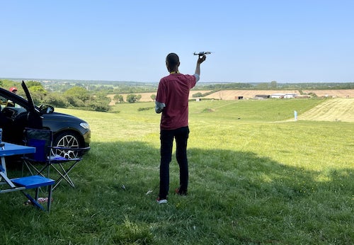
Barony Colliery A Frame added to Historic Buildings in Scotland by JoeC on 18/01/2020

Around a dozen free parking spaces available on site.

Fairly popular with dog walkers and close to the main road so distances may be tricky depending on the time of day and weather.

Land owner permission requirements unknown.

View and discuss this location in more detail on Grey Arrows.

Co-ordinates: 55.46828, -4.332207 • what3words: ///lifestyle.bunk.divorcing

The originator declared that this location was not inside a Flight Restriction Zone at the time of being flown on 18/01/2020. It remains the responsibility of any pilot to check for any changes before flying at the same location.

Where to fly your drone


Recently added locations

Portmeirion (By Dren)

Parked in carpark, walking through village and beyond lighthouse towards beach, follow gravel path to steps leading down to Sandy beach. Able to TOAL from estuary whilst tide was out. Quick flight upto village keeping my distance due to weight of drone.
Drone scene check before flight showed no warnings

Land owner permission requirements unknown.

View and discuss this location on Grey Arrows.

Co-ordinates: 52.90978, -4.101055 • what3words: ///young.carefully.massaging

Inverness Locks (By Bfarrell)

Another wee fly about at night getting used to the drone.

Nice calm night

Land owner permission not required.

View and discuss this location on Grey Arrows.

Co-ordinates: 57.48257, -4.247438 • what3words: ///universally.daring.locals

Aldourie Castle (By Bfarrell)

Took off from loch end.
A quick scoot down to the Castle. Just breaking in the new drone so I'll be back there for sure.

Land owner permission not required.

View and discuss this location on Grey Arrows.

Co-ordinates: 57.40802, -4.329088 • what3words: ///signal.couriers.steer

Cargill's Leap (By AlbionDrones)

The location of a 17thC Covenanter's escape from the redcoats, a rocky rapids in the River Ericht near Blairgowrie in Perthshire.

Park at the car park and then walk down the steps, and fly from the bridge - currently closed due to storm damage - or cross and walk further along the opposite bank.

Beware the trees and the double cable crossing the river upstream from the passenger footbridge.

Land owner permission not required.

View and discuss this location on Grey Arrows.

Co-ordinates: 56.59906, -3.340641 • what3words: ///renting.ranch.loom

Ballymorran Bay (By TristantheDog)

Great area to view a portion of Strangford Lough with its drowned drumlins created during the last ice age. Toal any where along the waters edge. Note area used by kayaker’s. Also when tide is out usually the are a fair number of wading bird. Also along the road on the land ward side are telephone lines. Other wise great spot.

Land owner permission not required.

View and discuss this location on Grey Arrows.

Co-ordinates: 54.46638, -5.655255 • what3words: ///choice.betraying.rewarding

Malmesbury Abbey (By jason5223)

My TOAL point was the Public pay and display car park 200 metres north of the abbey.
Be aware that the abbey sits about 120 feet above the car park level so be mindful of the height of your drone at this location

Land owner permission requirements unknown.

View and discuss this location on Grey Arrows.

Co-ordinates: 51.58458, -2.098292 • what3words: ///lectured.lawfully.rift

Marlborough High Street Wiltshire (By jason5223)

High Street in the historic town of Marlborough Wiltshire.
Parking on the high street and a very short walk to the churchyard behind the Town Hall.

The Churchyard has a wide open space to TOAL from

Land owner permission not required.

View and discuss this location on Grey Arrows.

Co-ordinates: 51.42143, -1.729977 • what3words: ///hubcaps.drumbeat.noon

North Landing Flamborough Head (By Paul01)

Truly a beautiful part of the UK coastline which can be very busy in the summer months. I was also advised caution flying too close to the cliffs as this is a nesting ground for many sea birds including puffins.

Land owner permission requirements unknown.

View and discuss this location on Grey Arrows.

Co-ordinates: 54.12955, -0.105405 • what3words: ///replaying.attic.squish

Scarborough Castle (By Paul01)

Quiet part of Scarborough coastline to take off from in the early morning when the tides in.

Land owner permission requirements unknown.

View and discuss this location on Grey Arrows.

Co-ordinates: 54.28761, -0.389457 • what3words: ///brief.action.salt

Beckenham Place Park Lake (By grandad1950)

A large park with a lake that permits wild swimming, but not for me. On some weekends they hold park fun runs so it can be busy at times

Land owner permission requirements unknown.

View and discuss this location on Grey Arrows.

Co-ordinates: 51.4202, -0.014218 • what3words: ///carry.wicked.happen


Show All Locations

Service provided by