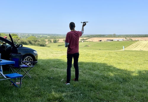
Where can I fly my drone in the UK and get £5,000,000 Public Liability Insurance cover? Welcome to Drone Scene!

Wondering where you can legally fly your drone? Looking for great places to fly? Looking for £5m Public Liability Insurance cover? Well look no further!

Welcome to Drone Scene, the place to find great drone flying locations in the UK, view images and videos posted by other pilots and share your flying locations in order to help other UK hobbyists find great locations where they can fly safely too.

Click on a marker pin to view details of that location. You can also add comments and discuss the location in our forum.

×You must login to see Airspace Restrictions, National Trust boundaries and other interactive map layers.

Loch of Clunie/Castle Clunie - Blairgowrie added to Castles and Fortifications in Scotland by mynameisjoe on 11/12/2022

Very popular in the summer with dog walkers and picnickers. Also, unfortunately, with clatty campers who turn up to trash the place, leave all their rubbish behind, and empty the loch of fish. The landowners have now blocked off much of the available parking bays and rangers now frequent the area, along with police, to discourage the clatty campers. Also popular all year round with canoists, paddle boarders and wild swimmers, it can be a very busy place. In the spring/summer a pair of Ospreys return to rebuild their nest and hopefuly raise some chicks. One of them is thought to be the offspring from the famoust residents at Loch of the Lowes, just a short drive away. So be mindful at this time of year, the locals are very protective of their ospreys and you could find yourself in a spot of bother, along with a visit from the police and wildlife protection officer!!!

The Loch of Clunie has a single island, said to be artificial, which has the remains of Clunie Castle. The house was built by George Brown Bishop of Dunkeld between 1485 and 1514 as a spiritual retreat. A chapel was dedicated to St Catherine in the house in 1507. It is thought that the island had been used as a crannog for many years previously. Human remains in the form of bones have been unearthed.

Built on a hillock on the western shore of the Loch is Old Clunie Castle. The castle replaced a hunting lodge used by Kenneth MacAlpin, King of the Picts, as a base for hunting in the nearby royal forest of Clunie. King Edward I of England stayed four nights in 1296 at the castle during his invasion of Scotland, before travelling to Inverquiech Castle. A place of Clunie is recorded in The Chronicle of the Kings of Alba as having been wasted by the Danes in 849, and as such is a scheduled monument of national importance.

Land owner permission not required.

View and discuss this location in more detail on Grey Arrows.

Co-ordinates: 56.57884, -3.450418 • what3words: ///chariots.eagles.inert

The originator declared that this location was not inside a Flight Restriction Zone at the time of being flown on 10/12/2022. It remains the responsibility of any pilot to check for any changes before flying at the same location.

Where to fly your drone


Recently added locations

Cargill's Leap (By AlbionDrones)

The location of a 17thC Covenanter's escape from the redcoats, a rocky rapids in the River Ericht near Blairgowrie in Perthshire.

Park at the car park and then walk down the steps, and fly from the bridge - currently closed due to storm damage - or cross and walk further along the opposite bank.

Beware the trees and the double cable crossing the river upstream from the passenger footbridge.

Land owner permission not required.

View and discuss this location on Grey Arrows.

Co-ordinates: 56.59906, -3.340641 • what3words: ///renting.ranch.loom

Ballymorran Bay (By TristantheDog)

Great area to view a portion of Strangford Lough with its drowned drumlins created during the last ice age. Toal any where along the waters edge. Note area used by kayaker’s. Also when tide is out usually the are a fair number of wading bird. Also along the road on the land ward side are telephone lines. Other wise great spot.

Land owner permission not required.

View and discuss this location on Grey Arrows.

Co-ordinates: 54.46638, -5.655255 • what3words: ///choice.betraying.rewarding

Malmesbury Abbey (By jason5223)

My TOAL point was the Public pay and display car park 200 metres north of the abbey.
Be aware that the abbey sits about 120 feet above the car park level so be mindful of the height of your drone at this location

Land owner permission requirements unknown.

View and discuss this location on Grey Arrows.

Co-ordinates: 51.58458, -2.098292 • what3words: ///lectured.lawfully.rift

Marlborough High Street Wiltshire (By jason5223)

High Street in the historic town of Marlborough Wiltshire.
Parking on the high street and a very short walk to the churchyard behind the Town Hall.

The Churchyard has a wide open space to TOAL from

Land owner permission not required.

View and discuss this location on Grey Arrows.

Co-ordinates: 51.42143, -1.729977 • what3words: ///hubcaps.drumbeat.noon

North Landing Flamborough Head (By Paul01)

Truly a beautiful part of the UK coastline which can be very busy in the summer months. I was also advised caution flying too close to the cliffs as this is a nesting ground for many sea birds including puffins.

Land owner permission requirements unknown.

View and discuss this location on Grey Arrows.

Co-ordinates: 54.12955, -0.105405 • what3words: ///replaying.attic.squish

Scarborough Castle (By Paul01)

Quiet part of Scarborough coastline to take off from in the early morning when the tides in.

Land owner permission requirements unknown.

View and discuss this location on Grey Arrows.

Co-ordinates: 54.28761, -0.389457 • what3words: ///brief.action.salt

Beckenham Place Park Lake (By grandad1950)

A large park with a lake that permits wild swimming, but not for me. On some weekends they hold park fun runs so it can be busy at times

Land owner permission requirements unknown.

View and discuss this location on Grey Arrows.

Co-ordinates: 51.4202, -0.014218 • what3words: ///carry.wicked.happen

Bedham Old Chapel (By Prawntot)

Beautiful woodland, lots of parking opportunities either right by the chapel (visible from the road) or a very pleasant walk away. The old Victorian chapel was used as a village school during the week and a church at the weekend and has been abandoned for the last 65 years. Drone with consideration of the fact that it sits *just* inside an SSSI and avoid disturbing wildlife.

Land owner permission requirements unknown.

View and discuss this location on Grey Arrows.

Co-ordinates: 50.98885, -0.554638 • what3words: ///heartened.districts.tugging

Dilhorne Quarry (By Grockerman)

Appears to be an abandoned quarry on the outskirts of Stoke. It's a quaint spot tucked away from the hustle and bustle. Accessible either from the public path or for the more agile, you can scale the gate. Permission might be required, though the only sign I spotted was about unauthorized motor vehicles. Parking is available just off the side of the road, and you can reach the area by following the public footpath."

You can park at: ///factory.relatives.scope
Fly from: ///evaporate.sliding.prep

Land owner permission requirements unknown.

View and discuss this location on Grey Arrows.

Co-ordinates: 52.99562, -2.064284 • what3words: ///selling.shameless.rescuer

Stonehaven War Memorial (By Buzbysmg)

The memorial is in the form of a classical temple. Most sources describe it as "round", though it is actually octagonal in shape. The structure has something of the appearance of an ancient ruin. This was deliberate, and meant to signify the many shortened and ruined lives caused by the conflict.

Access is via the footpath from Stonehaven harbour towards Dunnottar Castle. Land appears to be owned by Aberdeenshire Council, who at the time of flying and according to GADC FOI request response, have no byelaws relating to recreational drone use from its land.

Can get busy with walkers so you need to pick suitable time for least interference.

Land owner permission not required.

View and discuss this location on Grey Arrows.

Co-ordinates: 56.95502, -2.202866 • what3words: ///pods.passing.capacity


Show All Locations

Service provided by