Where can I fly my drone in the UK and get £5,000,000 Public Liability Insurance cover? Welcome to Drone Scene!

Wondering where you can legally fly your drone? Looking for great places to fly? Looking for £5m Public Liability Insurance cover? Well look no further!

Welcome to Drone Scene, the place to find great drone flying locations in the UK, view images and videos posted by other pilots and share your flying locations in order to help other UK hobbyists find great locations where they can fly safely too.

Click on a marker pin to view details of that location. You can also add comments and discuss the location in our forum.

×You must login to see Airspace Restrictions, National Trust boundaries and other interactive map layers.

St Mary's Parish Church added to Places of Worship in South West by StunningDrone on 10/06/2024

St Mary's Parish Church Iwerne Minster

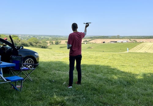
I spoke with the vicar when I arrived and he was happy with me flying.

He's seen the YouTube video and was extremely happy.

Land owner permission not required.

View and discuss this location in more detail on Grey Arrows.

Co-ordinates: 50.92949, -2.188748 • what3words: ///eruptions.unhappily.lungs

The originator declared that this location was not inside a Flight Restriction Zone at the time of being flown on 23/05/2024. It remains the responsibility of any pilot to check for any changes before flying at the same location.

Where to fly your drone


Recently added locations

Dark Sky Viewing Point, Trumpan, Waternish Peninsula, Skye (By AlbionDrones)

Amazing views over the Minch to the Outer Hebrides - when clear - and stunning coastal scenery of Waternish and Dunvegan peninsulas.

Park in the Trumpan Church Car Park and use the fenced-off area with picnic benches for TOAL, check with anyone else present that they are ok with you flying - it is quite remote, but there were people there on both occasions we visited, none had any issue with the drone flying...

Watch out for the MIDGES! They are fierce and have big sharp pointy teeth, either invest in some SMIDGE (other midge repellants are available) or take a sacrificial tasty snack for them, in my case the husband worked well, they seem to like him and will happily go and chase him, leaving me free to fly...

Land owner permission requirements unknown.

View and discuss this location on Grey Arrows.

Co-ordinates: 57.5574, -6.643789 • what3words: ///drifters.regulate.spooked

Salmon Farm (By BIGboyzelluf)

Salmon nursery at the island of Skye, lots of space to park your car.

Land owner permission not required.

View and discuss this location on Grey Arrows.

Co-ordinates: 57.26966, -6.076866 • what3words: ///stooping.perfected.political

Uig Harbour (By BIGboyzelluf)

Nice overnight stay, in the morning a very windy flight from the hill to the harbour of Uig, parking space for 6 vehicles.

Land owner permission not required.

View and discuss this location on Grey Arrows.

Co-ordinates: 57.59205, -6.372983 • what3words: ///growth.screaming.readjust

An Dubh Lochan, Angus of Fersit (By BIGboyzelluf)

Beautiful Loch, nice place to fly and swim also. Small parking place.

Land owner permission not required.

View and discuss this location on Grey Arrows.

Co-ordinates: 56.87183, -4.710475 • what3words: ///chip.singled.handicaps

Dunvegan Castle (By BIGboyzelluf)

Dunvegan Castle, take off from a small parking place north of the castle, lot of wind, but fun to fly !

Land owner permission requirements unknown.

View and discuss this location on Grey Arrows.

Co-ordinates: 57.44857, -6.589797 • what3words: ///since.samplers.truckload

Abandoned Farm (By BIGboyzelluf)

Very nice place, lots of parking spaces along the road.

Land owner permission not required.

View and discuss this location on Grey Arrows.

Co-ordinates: 56.74279, -3.64603 • what3words: ///animals.overheard.that

Loch an Eilein Castle (By BIGboyzelluf)

A short walk from the parking place to the loch, but it's worth it.

Land owner permission requirements unknown.

View and discuss this location on Grey Arrows.

Co-ordinates: 57.14899, -3.821873 • what3words: ///chitchat.emailed.lashed

Netham Lock (By richrab)

Netham Lock is the point at Netham in Bristol at which boats from the River Avon, acting as part of the Kennet and Avon Canal, gain access to Bristol's Floating Harbour.

https://en.wikipedia.org/wiki/Netham_Lock

TOAL from Feeder Road.

Land owner permission not required.

View and discuss this location on Grey Arrows.

Co-ordinates: 51.45201, -2.553938 • what3words: ///image.image.rarely

River Coe Gorge, Glencoe (By AlbionDrones)

The River Coe Gorge is a narrow river gorge running from the waterfall down alongside the main road - A82. It is filled with obstacles, trees, branches, rocks, and waterfalls and rapids, yet it makes an amazing place to fly FPV in a cinematic way.

Park in the layby and walk to the viewing platform, keep to the right and you will have a good view of the gorge entrance, your spotter needs to be nearby too.

If the drone loses connection you may find yourself having to take a swim to recover it as overhanging rock faces and trees will make it difficult for it to autoreturn. I flew about 300m down the gorge, using my AVATA and Goggles2 with the MC, at 300m I had 2 bars of transmission, so turned back at that point.

Be prepared to lose your drone if you attempt this amazing location...

Land owner permission requirements unknown.

View and discuss this location on Grey Arrows.

Co-ordinates: 56.66351, -4.970075 • what3words: ///dreamer.microchip.badge

Maiden Bower Hillfort (By B19DAE)

Park near the footbridge at the end of Sewell Lane and walk under the bridge turn left and follow the track up.

Be aware, Glider Club is near by and tow planes could be active too.

Land owner permission requirements unknown.

View and discuss this location on Grey Arrows.

Co-ordinates: 51.89201, -0.552558 • what3words: ///twigs.shaped.oasis


Show All Locations

Service provided by