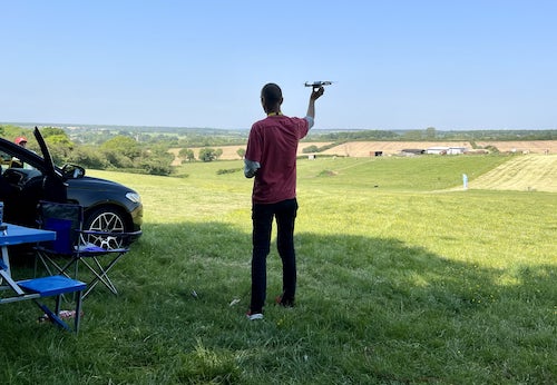
Where can I fly my drone in the UK and get £5,000,000 Public Liability Insurance cover? Welcome to Drone Scene!

Wondering where you can legally fly your drone? Looking for great places to fly? Looking for £5m Public Liability Insurance cover? Well look no further!

Welcome to Drone Scene, the place to find great drone flying locations in the UK, view images and videos posted by other pilots and share your flying locations in order to help other UK hobbyists find great locations where they can fly safely too.

Click on a marker pin to view details of that location. You can also add comments and discuss the location in our forum.

×You must login to see Airspace Restrictions, National Trust boundaries and other interactive map layers.

Ditchling Common added to Areas of Outstanding Natural Beauty in South East by grandad1950 on 20/02/2023

Lots of parking in common car park but be aware of the pot holes. Quite a few dog walkers but lots of space to TOAL

View and discuss this location in more detail on Grey Arrows.

Co-ordinates: 50.94663, -0.099794 • what3words: ///classic.professed.yourself

The originator declared that this location was not inside a Flight Restriction Zone at the time of being flown on 13/02/2023. It remains the responsibility of any pilot to check for any changes before flying at the same location. Landowner permission may be required before taking off.

Where to fly your drone

Filter ()
The Gaer, Newport (By TheJohnster)

The Gear is an Iron Age hillfort on the western outskirts of Newport, Gwent. Close to J28 on the Motorway, bordered by a railway on one side and a council estate & the motorway on the other sides of a roughly triangular site, it looks a bit unprepossessing, but I think it's got potential. It's badly overgrown, so the ditches and ramparts are not obvious, but at about 200' ASL, a drone reveals it's commanding position. With timber pallisates and cleared of trees, it must have been an impressive sight when it was built, about 400 BCE.

There is a clear space near the apex of the triangle, the highest point, and it is this that I have marked on the map. Once above the treeline, there are no obstacles and the position offers good views over the port, the Severn Estuary, the Gwent levels, Cardiff and the hills beyond, the Ebbw & Sirhowy Valleys, the Usk Valley, and the Wentwood hills.

I flew there yesterday evening and it was a disappointment, as a previously pleasant late afternoon morphed into a dreich & drear evening. I plan to return if I get a good autumn or winter day, when the trees will bare. The vistas should be spectacular in clear conditions.

I went by bus from Cardiff and walked from the stop, about 25 mins at my old man speed. Parking is freely available on the surrounding estate streets, which looked and felt quite 'safe'. Come off the Motorway at J27 High Cross, and take the B4591 towards city centre. 2nd exit at roundabout approx half-mile on to B4240, then about quarter mile turn sharp right on to Bassaleg Road at 'The Hand Post' Pub. With St.Woolos' Cememtery to your right, look out for left on to Gaer Park Drive, and follow that to the end. Short walk to the TOAL positon.

The site is an SSSI, but for historical/archaeological reasons rather than because of wildlife, so this will not impact your flying.

View and discuss this location on Grey Arrows.

Co-ordinates: 51.576, -3.026423 • what3words: ///shed.hike.piles

Minety Lake, Cotswold (By D0c.Col)

MINETY LAKE, LOWER MILL ESTATE

Lower Mill Estate, The Cotswolds, is a private estate amidst lakeside trails, rivers and hundreds of acres of green space. It boasts an award winning spa, numerous swimming pools, an outstanding restaurant and an activity centre. Whether you hire a kayak, try your hand at paddle boarding, practice your serve or enjoy a drink on your private decking. Minety Lake is just one of the beautiful water features of the Cotswold Water Park area not far from Cirecester.

Link to their website: https://lowermillestate.com/

View and discuss this location on Grey Arrows.

Co-ordinates: 51.64696, -1.973406 • what3words: ///unto.outnumber.marzipan

Barton Marina, East Staffordshire (By D0c.Col)

Barton Marina is situated on the Trent & Mersey Canal in rural Staffordshire near Barton-under-Needwood.

Barton Marina offers canal boaters an ideal location to moor their boat, whether that's short-term, long-term, or residential. At the heart of the UK canal network, Barton Marina is home to over 300 boats, all of which enjoy secure electric gates on the jetties and mains water, changing facilities, toilets and showers, docking-repair and boatyard services. Barton Marina is also home to a host of restaurants (one of which has a cinema), cafés, independent retailers and grocers, so you have everything you need for a comfortable and relaxing stay.

View and discuss this location on Grey Arrows.

Co-ordinates: 52.75964, -1.707543 • what3words: ///shuttled.contexts.cookery

Hatton Old Water Pumping Station, Stafford (By D0c.Col)

Due to rising water demand in the late 19th century, particularly from the increased use of water closets, the Staffordshire Potteries Water Company sought new water sources. A promising site was found on the Swynnerton Estate, owned by Basil T. Fitzherbert. Following successful test drilling, the company secured approval in 1888 to build Hatton Water Works, which was developed in stages over 20 years. It initially featured multiple steam engines and wells, with full completion by 1907. Between 1937 and 1959, the steam machinery was replaced by electric pumps powered by diesel generators. Some original engines have been preserved and are now part of a museum open a few days each year. In recent years, the historic buildings have been converted into residential apartments known as Hatton Manor, with care taken to preserve the site's architectural character. The main complex is now a Grade II* listed building.

The pumping station is now private land but a respectful flight is still possible to show the main pump house etc.

View and discuss this location on Grey Arrows.

Co-ordinates: 52.92996, -2.255298 • what3words: ///rollover.stoops.tour

St Chads Church, Shrewsbury and Atcham (By D0c.Col)

St Chad's Church is a well known Grade I listed building located in a prominent position opposite The Quarry Park in Shrewsbury, Shropshire. The church was a replacement for a 13th-century building which was essentially destroyed after the collapse of its central tower in 1788.

Charles Darwin was baptised in St Chad's in 1809, and as a young boy he attended the church with his mother.

After some confusion, the circular plan of the Scottish architect, George Steuart, was accepted even though the planning committee had first rejected it for a more traditional oblong church. However, the planning process had been so fraught by argument and delay that the committee eventually thought it preferable to simply go ahead with the round design.

The Churches foundation stone was laid on St Chad's day in 1790 and took just over two years for it to be completed finally opening in August 1792. The building work was supervised by John Simpson who went on to work on several other projects with Thomas Telford, including the Pontcysyllte Aqueduct.

Parking in Shrewsbury is plentiful but expensive and well within walking distance of the Park adjacent to the Church.

View and discuss this location on Grey Arrows.

Co-ordinates: 52.70729, -2.758935 • what3words: ///danger.sport.loans

Great Barr Hall, Walsall (By D0c.Col)

In the mid-17th century, Richard Scott Purchased, Nether House and around 1777, Joseph Scott (later Sir Joseph Scott, 1st Baronet Scott of Great Barr) replaced the old house with a two-storey, nine-bay mansion now known as Great Barr Hall. The house was much altered and extended about 1840 and in 1863.
Financial problems led the Scott Family to lease out the hall from about 1788 to Samuel Galton, and for some years the Hall became a venue for meetings of the Lunar Society. In 1791, Sir Francis Scott, 3rd Baronet, inherited the manor of Great Barr from his maternal uncle Thomas Hoo and was able to return to live in the house on the expiry of the lease. He died in 1863 and his widow Mildred lived on in the Hall until her death in 1909. In 1911, the estate was purchased by a local hospital board and, in 1918, became St Margaret's Mental Hospital. In the 1980s the grounds became a nature reserve, managed by the Staffordshire Nature Conservation Trust but the hall itself was abandoned in 1978 despite its 1971 Grade II* listing. Great Barr Hall and Park came on the market in 1912 West Bromwich Guardians saw its purchase from the trustees of the Scott family as a solution to their own particular problems. The principal lot of 557 acres, comprising Great Barr Hall and Park was snapped up for a modest £28,000. In May 2011 the hall, still in ruins, was put up for sale for £2.2 million.n early February 2012 with a guide price of £1,250,000. Unfortunately, the highest bid was £1,140,000, and so it again remained unsold. In May 2012, it was sold to a consortium of ten local residents who subsequently commissioned Lapworth Architects to consult with the public and investigate potential new uses for the hall. Today the hall along with 154 ACRES of PARKLAND with 2 LAKES is up for sale; parts of it are available for POTENTIAL development for a guide price in excess of £7,000,000’s!

Parked on Sutton Drive and walked down the Lane. TOAL right next to Hall.

View and discuss this location on Grey Arrows.

Co-ordinates: 52.55626, -1.920912 • what3words: ///gained.allows.bank

Penhow Castle, Newport (By gasbag43)

Penhow Castle dates from the early 12th century. Extended and reconstructed in almost every century since, it has been claimed to be the oldest continuously-inhabited castle in Wales. The castle is a Grade II listed building.

The manor of Penhow was held by Caradog ap Gruffydd, prince of Gwent at the time of the Norman invasion of Wales. The estate was seized by the Seymour family (anciently de St. Maur) and by 1129, Sir Roger de St Maur had built a fortified manor at the site.

The house was extended and further fortified in the 15th and 17th centuries. In the 16th century, the manor passed to the Somersets. In 1674, it was purchased by the Lewis family of St Pierre. Viscount Rhondda, an industrialist and conservator of ancient buildings in Wales, bought the castle in 1914, but by the mid-20th century, the castle was in a state of some dilapidation, until bought and restored by the film director Stephen Weeks.

During his tenure, the castle was open to the public, while also serving as Weeks’ residence. In 2002, it was sold and reverted to a private home.

View and discuss this location on Grey Arrows.

Co-ordinates: 51.61361, -2.833571 • what3words: ///slate.develops.confetti

South Norwood Lake, Croydon (By grandad1950)

The largest man made area of open water in the London Borough of Croydon. Sailing, fishing, a good walk and interesting views towards Crystal Palace

View and discuss this location on Grey Arrows.

Co-ordinates: 51.40715, -0.074185 • what3words: ///expect.start.pirate

Church of St Mary's, Monmouthshire (By gasbag43)

The Church of St Mary stands in the centre of the village of Magor, Monmouthshire. It was designated a Grade I listed building in 1963.

The oldest parts of the church are the chancel and tower which date from the 13th and 14th centuries, although a church is purported to have been founded here as early as the 7th century by Cadwaladr Fendigaid who was a Welsh prince and the last Welsh ruler to call himself King of Britain - he died of the plague in 664 AD.

The church was subsequently dedicated to St Leonard, until the mid-nineteenth century restoration, when it was rededicated to St Mary.

The large nave with both north and south aisles was rebuilt in the 15th century. The elaborate north porch was added possibly as late as 1510-1520 and it can be seen how the north aisle had to be adapted to allow for the addition of the porch.

Next to the church stands The Procurator's House, a sixteenth-century house, now ruined, which belonged to the vicarage of Magor

View and discuss this location on Grey Arrows.

Co-ordinates: 51.57873, -2.83075 • what3words: ///inflamed.digs.twigs

Heston Brake, Monmouthshire (By gasbag43)

The long barrow near Portskewett is called Heston Brake. It's a Neolithic chambered tomb located in a field on a hill overlooking the Severn Estuary. The site is also known as a "dolmen" or "cairn".

Heston Brake is situated in a field near Portskewett, specifically on the brow of a hill overlooking the Severn Estuary. It's about half a mile northeast of Portskewett

The entrance to the barrow is marked by a small group of puddingstones. In 1888, the chamber of the barrow was excavated and human skeletons, cattle bones, and pottery were found.

The site is on private land but can be accessed via a public footpath. The footpath is reached by a kissing gate about 150 meters from the main road towards Leechpool.

Be wary of lots of overhead cables criss-crossing the site

The barrow is over 4,000 years old, dating back to the Neolithic period. It is considered a significant site and is sometimes mentioned alongside other dolmens like Garn Llwyd and Gwern-y-Clepp

View and discuss this location on Grey Arrows.

Co-ordinates: 51.59452, -2.715415 • what3words: ///listings.referral.bookcases


Show All Locations

Service provided by