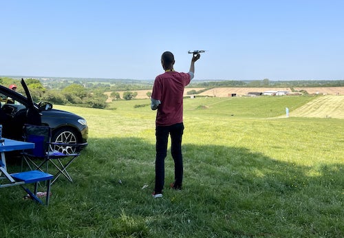
Where can I fly my drone in the UK and get £5,000,000 Public Liability Insurance cover? Welcome to Drone Scene!

Wondering where you can legally fly your drone? Looking for great places to fly? Looking for £5m Public Liability Insurance cover? Well look no further!

Welcome to Drone Scene, the place to find great drone flying locations in the UK, view images and videos posted by other pilots and share your flying locations in order to help other UK hobbyists find great locations where they can fly safely too.

Click on a marker pin to view details of that location. You can also add comments and discuss the location in our forum.

×You must login to see Airspace Restrictions, National Trust boundaries and other interactive map layers.

Southrey Church added to Places of Worship in East Midlands by john768 on 12/01/2022

The little church of St John the Divine at Southrey in Lincolnshire is far from being a typical English country church, more like something that has been transported from New England.

Built by the parishioners and a local carpenter Richard Turner in 1898 at a cost of about £130 as a temporary structure, and is not subject to Faculty. The neat little gabled and belfry timber building was covered in PVC to protect the original wood. The church rests on a concrete plinth incorporating stones from the nearby ruins of Bardney Abbey. Maintenance has recently included redecorating in white and sky blue along with recarpeting.

The church now boasts a wonderful new five paned stained glass window to commemorate World War I and the sacrifice made by all the servicemen from the village during the last 100 years. A book has been compiled to show the lives of this men and their families and is available for purchase at the church. Memorials in the churchyard from that time have also been cleaned and restored.

The most recent addition to the church is a fully disabled access composting toilet and new storage facility, money raised for this amounted to £28,000. The church holds a service every week and the doors are open 365 days a year. Regular meetings of Knit and Natter for the residents takes place weekly long with children's workshops during the school holidays. Speakers evenings give another dimension to the village with talks from Bees to World War I Aviation and crafts from Chirstmas cake decoration to glass painting. All visitors are welcome to take pictures and sign the visitor’s book, which helps to enhance future projects for the upkeep of this site. The site is accessible to all. In 2016 the church was awarded the Lincolnshire Heritage Forum Best Volunteer Project for its stain glass window.
Key Features

Land owner permission not required.

View and discuss this location in more detail on Grey Arrows.

Co-ordinates: 53.18426, -0.297205 • what3words: ///jugs.plus.ordinary

The originator declared that this location was not inside a Flight Restriction Zone at the time of being flown on 12/01/2022. It remains the responsibility of any pilot to check for any changes before flying at the same location.

Where to fly your drone


Recently added locations

Holbeck - Scarborough Southbay (By Paul01)

Great view of Scarborough Southbay from the land formation made when the Holbeck was destroyed in a landslide.

Free parking all year round :-)

Land owner permission requirements unknown.

View and discuss this location on Grey Arrows.

Co-ordinates: 54.26871, -0.390396 • what3words: ///fact.chins.scared

Tilehurst Water Tower (By apreading)

Erected in 1932, Tilehurst Water Tower, is an iconic landmark on the ridge line in Tilehurst, a district in the Western part of Reading. People from Reading know they are near home when they are coming along the M4 from the West and they can see the top of the tower, several miles before they get to Junction 12.

In November 2018 the tower was illuminated in poppy red to mark 100 years since the end of the First World War. The tower remained illuminated, and visible at night from a wide area, until Remembrance Day on 11 November.

It still fulfils its function as a water tower today, and at the top it also houses a number of telephone masts and receivers and also the transmitter for Greatest Hits Radio Berkshire & North Hampshire, a local radio station.

The tower holds a huge 900,000 litres of water, in two 4.5 metre deep tanks and provides around 10 per cent all the water used in Reading, serving 12,000 homes and businesses.

Land owner permission not required.

View and discuss this location on Grey Arrows.

Co-ordinates: 51.45163, -1.047077 • what3words: ///knee.pose.sand

Deangate Ridge Country Park (By RestlessZombi)

This has been the site of many Drone Meetups. Camera Drones, FPV Drones and Fixed Wings have been flown around this area without issue.

Often used by Dog Walkers.

Security Guard is happy with Drones being flown and likes biscuits.

Park in the Car Park for free and walk to site.

Land owner permission not required.

View and discuss this location on Grey Arrows.

Co-ordinates: 51.43191, 0.547509 • what3words: ///skillet.example.forgiven

Scar House Reservoir (By Sleepwalker)

Its a free carpark only about 5 mins away from the first dam if you stick to the left its foot path to the seconed dam but if you dont mind hiking and have appropriate footware then you can do a full circle around the reservoir

Land owner permission requirements unknown.

View and discuss this location on Grey Arrows.

Co-ordinates: 54.1877, -1.907498 • what3words: ///wreck.multiply.recipient

Rhosydd Quarry (By Dren)

Rather wet, muddy walk upto Rhosydd quarry from the Llyn Cwmorthin lake below. Carpark is situated just outside Tanygrisiau, steep narrow roads upto carpark. Gives you an idea of the paths elevation upto plateau. You can fly anywhere here there are no restrictions in the area. Old slate buildings and ruins everywhere

Land owner permission not required.

View and discuss this location on Grey Arrows.

Co-ordinates: 53.00009, -3.978918 • what3words: ///womanly.holly.momentous

Rottingdean (Undercliff Walk) (By Markm0)

You can park in the Marine Cliffs pay and display carpark.

Land owner permission requirements unknown.

View and discuss this location on Grey Arrows.

Co-ordinates: 50.80204, -0.055248 • what3words: ///butter.spud.takeover

Kelsey Park Beckenham (By grandad1950)

A local nature reserve with lots of water fowl and birds to enjoy. Well manicured gardens, Ideal for a relaxing short break

Land owner permission requirements unknown.

View and discuss this location on Grey Arrows.

Co-ordinates: 51.40097, -0.021998 • what3words: ///dome.clips.jazzy

Portmeirion (By Dren)

Parked in carpark, walking through village and beyond lighthouse towards beach, follow gravel path to steps leading down to Sandy beach. Able to TOAL from estuary whilst tide was out. Quick flight upto village keeping my distance due to weight of drone.
Drone scene check before flight showed no warnings

Land owner permission requirements unknown.

View and discuss this location on Grey Arrows.

Co-ordinates: 52.90978, -4.101055 • what3words: ///young.carefully.massaging

Inverness Locks (By Bfarrell)

Another wee fly about at night getting used to the drone.

Nice calm night

Land owner permission not required.

View and discuss this location on Grey Arrows.

Co-ordinates: 57.48257, -4.247438 • what3words: ///universally.daring.locals

Aldourie Castle (By Bfarrell)

Took off from loch end.
A quick scoot down to the Castle. Just breaking in the new drone so I'll be back there for sure.

Land owner permission not required.

View and discuss this location on Grey Arrows.

Co-ordinates: 57.40802, -4.329088 • what3words: ///signal.couriers.steer


Show All Locations

Service provided by