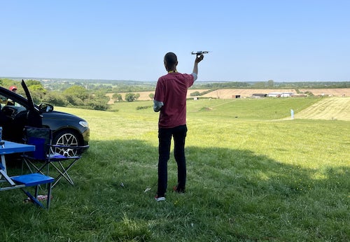
Where can I fly my drone in the UK and get £5,000,000 Public Liability Insurance cover? Welcome to Drone Scene!

Wondering where you can legally fly your drone? Looking for great places to fly? Looking for £5m Public Liability Insurance cover? Well look no further!

Welcome to Drone Scene, the place to find great drone flying locations in the UK, view images and videos posted by other pilots and share your flying locations in order to help other UK hobbyists find great locations where they can fly safely too.

Click on a marker pin to view details of that location. You can also add comments and discuss the location in our forum.

×You must login to see Airspace Restrictions, National Trust boundaries and other interactive map layers.

Thrapston Lakes, Northamptonshire added to Parks and Recreation in East Midlands by Skyrunner1 on 13/10/2021

Land owner permission requirements unknown.

View and discuss this location in more detail on Grey Arrows.

Co-ordinates: 52.4031, -0.541892 • what3words: ///vesting.nimbly.spokes

The originator declared that this location was not inside a Flight Restriction Zone at the time of being flown on 12/10/2021. It remains the responsibility of any pilot to check for any changes before flying at the same location.

Where to fly your drone


Recently added locations

Standon Hall, Staffordshire (By D0c.Col)

Standon Hall was built in 1910 as a manor house to the design of Liverpool architect J. Francis Doyle, and is located in Standon near Ecceshall, Staffordshire.
The Hall was formerly owned and built for Sir Thomas Anderton Salt, a director of the North Staffordshire Railway company, but its use as a family home was short-lived and was sold to Staffordshire County Council in 1925 for subsequent use as a hospital.
The establishment of pavilions for tuberculosis patients in 1930 and its successive orthopaedic treatment in the Hall itself established its role in providing medical care during critical periods in history, particularly in the early to mid-20th century when such diseases were prevalent. The medical facilities were also utilised in 1939 when it was temporarily requisitioned by the War Office to care for wounded soldiers.
Upon the opening of Stafford General Hospital in 1983, the NHS sold the property into the private sector and the manor house itself was converted into a residential care home for up to 22 elderly ladies and gentlemen and the outbuildings, then known as "The Beeches", specialised in dementia care for an additional 21 elderly residents.
Some 30 years later, plans were submitted to convert the hall into 19 apartments, and outbuildings into seven new homes, but the planning permission for the venture was eventually rejected in 2018.
The hall’s future was uncertain, like many old and abandoned buildings within the UK, it seemed destined to fall into disrepair, However, in 2019 the Grade II-listed hall, that had stood empty for several years and was being considered for auction, was purchased for the princely sum of £1.2 million by local entrepreneurs Joanne and Andrey Magiy and their journey to transform the disused building into a stunning wedding and events venue begun.
The Hall’s architectural significance and adaptive reuse reflect its enduring importance within the local community and after much hard graft and dedication to the task by their team; the building was rescued from dereliction and is now fully restored.

I parked in the hall's grounds and the management team at Standon granted me permission to film there.

Land owner permission obtained.

View and discuss this location on Grey Arrows.

Co-ordinates: 52.91552, -2.286529 • what3words: ///wordplay.automatic.pronouns

Waterwynch Bay / Brownslade Bay (By DaveJaVu)

There is room for parking for a couple of cars at the top of Waterwynch Lane. The driveway itself is a public footpath but is NOT open to vehicles. It is just under a 1km walk to the beach from the main road. Alternatively park on The Croft in Tenby itself, there is a footpath down to the beach and again it's about 1km along the beach to Waterwych Bay. It is fully accessible at medium / low tide. It is *completely* cut off at high tide so do keep a close eye on tide times!

Fantastic spot with miles of beaches, 300ft tall cliffs, and a few caves too! 🤩

Land owner permission not required.

View and discuss this location on Grey Arrows.

Co-ordinates: 51.68632, -4.695196 • what3words: ///inclines.sniff.prestige

Quarr Abbey, Isle of Wight (By KevNewton)

No permission required. TOAL available on the footpath that runs parallel to the car park. Open 24/7

Land owner permission not required.

View and discuss this location on Grey Arrows.

Co-ordinates: 50.73157, -1.205052 • what3words: ///expect.weeks.puns

Drakeholes (By Woody305)

The Duck At Drakeholes. Lovely spot to see Narrow Boats on the Chesterfield Canal and have a cool drink or a bite to eat. TOAL was parked up at side of Wiseton Road.Clear LOS

Land owner permission not required.

View and discuss this location on Grey Arrows.

Co-ordinates: 53.40559, -0.938813 • what3words: ///helpers.pots.supposing

Denbigh Asylum Ruins (By Dren)

Flew here today after much research, no actual access to site as is actively protected by security guards hiding in building wearing kharki, combat clothing was reported on other sites this their attitude to combat trespass. My drone did draw two guards out of cover whilst hovering above incredible old building in poor disrepute.

Land owner permission requirements unknown.

View and discuss this location on Grey Arrows.

Co-ordinates: 53.17417, -3.421029 • what3words: ///hippy.divided.hillsides

Gamelands stone circle (By markas)

Gamelands stone circle lies between the village of Orton and the hamlet of Raisbeck. It is an oval enclosure of around 40 large stones, all of which have fallen, together with three smaller stones. The stones are set into a slight bank. All of the stones are of pink granite with the exception of one which is limestone. The stones are all below one metre in height and are arranged in an oval of 42 metres by 35 metres.

Land owner permission requirements unknown.

View and discuss this location on Grey Arrows.

Co-ordinates: 54.46751, -2.556853 • what3words: ///bonkers.ghosts.opposing

Teignmouth (By richrab)

Teignmouth is a seaside town, fishing port and civil parish in the English county of Devon. It is on the north bank of the estuary mouth of the River Teign, about 12 miles (19 km) south of Exeter.

Parked Car and TOAL from the Ness Car park.

Land owner permission not required.

View and discuss this location on Grey Arrows.

Co-ordinates: 50.53737, -3.499931 • what3words: ///emporium.screeches.breathing

Paignton - Devon (By richrab)

Paignton is a seaside town on the coast of Tor Bay in Devon, England. Together with Torquay and Brixham it forms the borough of Torbay which was created in 1968. The Torbay area is a holiday destination known as the English Riviera.

TOAL from a Bench on the promenade.
Last week in March so not many people about.

Land owner permission not required.

View and discuss this location on Grey Arrows.

Co-ordinates: 50.43277, -3.558799 • what3words: ///among.keeps.brass

Dartmouth - Devon (By richrab)

Dartmouth is a town and civil parish in the English county of Devon. It is a tourist destination set on the western bank of the estuary of the River Dart, which is a long narrow tidal ria that runs inland as far as Totnes. It lies within the South Devon Area of Outstanding Natural Beauty.

TOAL and Parking was on Higher Contour Road. ///roofed.clenching.glider

Land owner permission not required.

View and discuss this location on Grey Arrows.

Co-ordinates: 50.3489, -3.568722 • what3words: ///sings.rezoning.fists

Loch Dunmore, Faskally Forest, Perthshire (By AlbionDrones)

Park up at the Forestry Commission car park - there is a charge, but also toilets - and walk the short distance to the loch to find a spot for TOAL, we chose the path near the bridge and flew from there.

It can get busy at certain times of day and year, especially when the Fantasy Forest is on in the Autumn, but definitely worth a stop, the reflections are awesome in the sheltered and still water...

Land owner permission requirements unknown.

View and discuss this location on Grey Arrows.

Co-ordinates: 56.71111, -3.765409 • what3words: ///galloped.pouch.store


Show All Locations

Service provided by