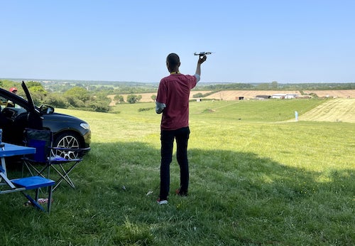
Wondering where you can legally fly your drone? Looking for great places to fly? Well look no further!
Welcome to Drone Scene, the place to find great drone flying locations in the UK, view images and videos posted by other pilots and share your flying locations in order to help other UK hobbyists find great locations where they can fly safely too.
Click on a marker pin to view details of that location. You can also add comments and discuss the location in our forum.
Free Parking at TF6 5AL (approx.) MTB, Dog friendly, gentle 1mile walk to summit up reasonable path.Occasionally No Fly due to Paragliders.Height: 407m (1335ft)Excellent views of Shropshire and Wales from the top.The Wrekin is the subject of a well-known legend in Shropshire folklore. A giant called Gwendol Wrekin ap Shenkin ap Mynyddmawr with a grudge against the town of Shrewsbury decided to flood the town and kill all its inhabitants. So he collected a giant-sized spadeful of earth and set off towards the town. When in the vicinity of Wellington he met a cobbler returning from Shrewsbury market with a large sackful of shoes for repair. The giant asked him for directions, adding that he was going to dump his spadeful of earth in the River Severn and flood the town. "It's a very long way to Shrewsbury," replied the quick-thinking shoemaker. "Look at all these shoes I've worn out walking back from there!" The giant immediately decided to abandon his enterprise and dumped the earth on the ground beside him, where it became the Wrekin. The giant also scraped the mud off his boots, which became the smaller hill Ercall Hill nearby. Ironically Shrewsbury is subjected to flooding from the River Severn on frequent occasions naturally.
Land owner permission requirements unknown.
View and discuss this location on Grey Arrows.
Co-ordinates: 52.66946, -2.545481 • what3words: ///sleepers.firebird.chatting
Excellent spot for flying. on top of Breidden Hill.
Co-ordinates: 52.72275, -3.045121 • what3words: ///giving.deliver.thinnest
Set of 5 Locks, good nearby parking. Just outside the TernHill FRZ.
Co-ordinates: 52.88882, -2.461254 • what3words: ///clinic.depravity.agrees
Log in to gain access to multiple layers of additional airspace information and ground hazards in order to enhance the safety of your planned flights.
Real-time airspace data is provided by Altitude Angel, an aviation technology company which creates global-scale solutions to enable the safe integration and use drones in airspace.
Copy the URL from the box below to share this location and zoom level.
Drone Scene uses Single Sign On (SSO) to manage your account.
You will be redirected to the Grey Arrows Drone Club web site to confirm your credentials.
Once confirmed, you will be automatically redirected back here.
Are you sure you want to log out?