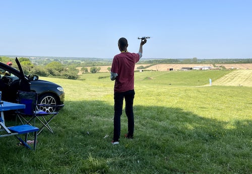
Where can I fly my drone in the UK and get £5,000,000 Public Liability Insurance cover? Welcome to Drone Scene!

Wondering where you can legally fly your drone? Looking for great places to fly? Looking for £5m Public Liability Insurance cover? Well look no further!

Welcome to Drone Scene, the place to find great drone flying locations in the UK, view images and videos posted by other pilots and share your flying locations in order to help other UK hobbyists find great locations where they can fly safely too.

Click on a marker pin to view details of that location. You can also add comments and discuss the location in our forum.

×You must login to see Airspace Restrictions, National Trust boundaries and other interactive map layers.

Wollaton Hall added to Everything Else in East Midlands by Airlessmean on 16/02/2021

You need to go to the Wollaton Hall web site and look for people too contact for permission as they have a drone policy in place.

Land owner permission obtained.

View and discuss this location in more detail on Grey Arrows.

Co-ordinates: 52.94786, -1.210076 • what3words: ///magic.down.tape

The originator declared that this location was not inside a Flight Restriction Zone at the time of being flown on 15/02/2021. It remains the responsibility of any pilot to check for any changes before flying at the same location.

Where to fly your drone


Recently added locations

Kings Cross & St Pancras stations (By ParmoPaul)

TOAL is from the corner of Crestfield and St Chads Streets.

Camden Council don’t have any specific drone bylaws at the moment, but they don’t give permission to fly from their parks.

Land owner permission requirements unknown.

View and discuss this location on Grey Arrows.

Co-ordinates: 51.53061, -0.123907 • what3words: ///fund.spider.wisely

Peacehaven Steps (By Sammie99)

If you don't mind a bit of a walk it is better to use the steps and go to the bottom of the cliff as there is a nice wall to sit on by the sea. Also it means you don't experience quite the same fear of heights by being at the top!

Land owner permission not required.

View and discuss this location on Grey Arrows.

Co-ordinates: 50.78521, 0.019231 • what3words: ///elbowing.adverbs.engine

Titsey Place and Parklands (By grandad1950)

It was closed when I went ( should have checked opening times) but potentially an interesting house to visit. Rolling parkland and woodland to explore and a working farm in the grounds.

Land owner permission requirements unknown.

View and discuss this location on Grey Arrows.

Co-ordinates: 51.2776, 0.015309 • what3words: ///admits.toward.modes

Cardigan Island and Coast (By Steviegeek)

The coast line of the Afon Teifi outlet just west of Cardigan as it meets the St. Georges Channel.
The island is Cardigan Island, uninhabited except for a few birds.

I flew from the coastal path which is designated as a Public Footpath. there are a few benches along the way.
Parking is in the uncontrolled, free, hotel carpark with path access from there.

Land owner permission not required.

View and discuss this location on Grey Arrows.

Co-ordinates: 52.13224, -4.687647 • what3words: ///nearly.sedative.readings

Queens Drive (Walk) (By Bluesjnr)

Beware SSSI's around this area, especially during breeding season. Park in town and head South out of town.

Path can be accessed opposite caravan park at ///tour.contained.selling. The path will take you back into town (around 3 miles all in).

Land owner permission requirements unknown.

View and discuss this location on Grey Arrows.

Co-ordinates: 56.99943, -3.38886 • what3words: ///harps.earphones.airbrush

Strumble Head and Lighthouse (By Steviegeek)

I visited on a wet, windy and very grey day. I suggest you go on a nice sunny clear sky day 😃
There is parking space but no amenities. The lighthouse is open some days but don't know exactly when so if you want to go inside check beforehand to avoid disappointment

Land owner permission requirements unknown.

View and discuss this location on Grey Arrows.

Co-ordinates: 52.0298, -5.073543 • what3words: ///takers.bunkers.manicured

Blairgowrie and River Ericht (By AlbionDrones)

Blairgowrie is a small town in Perthshire, straddling the River Ericht, known as the home of Scottish Fruits greenhouses orchards and raspberry canes surround it. The town centre is small and can be walked in about 10 minutes, but backs onto the river, and a riverside park provides a lovely TOAL place.

Park on the road near the Wellmeadow square and you have an hour free parking.

Land owner permission requirements unknown.

View and discuss this location on Grey Arrows.

Co-ordinates: 56.59195, -3.335388 • what3words: ///desk.voucher.protrude

Durham Cathederal (By Briang97)

Good spot to toal gives a great capture of the horseshoe bend on the river with the castle and cathedral in the background, well worth a shot when the trees have autumn colour on.

You might get a warning from the prison as they've extended to zone but you are still within the distance from the prison to get some shots.

Land owner permission requirements unknown.

View and discuss this location on Grey Arrows.

Co-ordinates: 54.7733, -1.576323 • what3words: ///hands.flips.ties

South Norwood Country Patk (By grandad1950)

Wide open space in the London Borough of Croydon. Walks, woodland and lakes await.

Land owner permission requirements unknown.

View and discuss this location on Grey Arrows.

Co-ordinates: 51.39879, -0.05546 • what3words: ///librarian.wicked.loss

Cranfleet Cut and Cranfleet Lock (By Ubique_Photo)

I parked at the what3words location "rank.theme.rams" at the end of Pasture Lane and took a nice stroll along the river to the location shown on the map. It is a public right of way and was really quiet. But watch out for MTB's and I always gave room for any walkers etc, by moving the drone away.

Clearly privacy ethos living on the boats is to be kept in mind although they were lovely to chat to and just interested.
I then moved to a place nearer to the car park at the lock cafe to maintain visuals.

Land owner permission not required.

View and discuss this location on Grey Arrows.

Co-ordinates: 52.87805, -1.260413 • what3words: ///stick.epic.strike


Show All Locations

Service provided by