Where can I fly my drone in the UK and get £5,000,000 Public Liability Insurance cover? Welcome to Drone Scene!

Wondering where you can legally fly your drone? Looking for great places to fly? Looking for £5m Public Liability Insurance cover? Well look no further!

Welcome to Drone Scene, the place to find great drone flying locations in the UK, view images and videos posted by other pilots and share your flying locations in order to help other UK hobbyists find great locations where they can fly safely too.

Click on a marker pin to view details of that location. You can also add comments and discuss the location in our forum.

×You must login to see Airspace Restrictions, National Trust boundaries and other interactive map layers.

Welford Park added to Historic Buildings in South East by clinkadink on 25/02/2023

Parking: 51.460021, -1.415705
TOAL: 51.455132, -1.412745

There is a free car park just north of the park and then a 5 minute walk to the park. It costs £12 to get in, it is open 11 am to 5 pm. I got there at 4 pm, so haggled him down to a tenner.

During the Middle Ages, the monks of Abingdon Abbey owned the manor of Welford. The Dissolution of the Monasteries stripped the abbey of its possessions, but rather than sell off Welford, Henry VIII kept it for himself as a hunting lodge. Then in 1546, he granted it to Sir Thomas Parry, a courtier and later Treasurer to Elizabeth I.

In 1618 the Parry's sold Welford to Sir Francis Jones, soon to become Lord Mayor of London. This is the only time in the long history of Welford Park that the estate has been sold. In 1652 Richard Jones, Sir Francis' grandson, had the elegant brick house we see today built by architect John Jackson. Richard died without a male heir, and his daughter Mary married John Archer.

It was an altogether different Archer who had a more profound effect on Welford. In 1700 Thomas Archer married Eleanor Archer, Mary's daughter. Despite the confusion of names, Thomas was not related to the Welford Archers. He was, however, set to become one of the great architects of early 18th century England, and would leave his stamp on some of the great country houses of the day. The Jacobean house at Welford was really his first major essay at architecture. Archer renovated the front facade, adding Ionian columns to create a neoclassical look, and raised the roof by adding another storey.

An even bigger transformation came later, however, in 1840, when a courtyard behind the house was filled in to create the exceedingly large dining room.

The next few generations of Welford owners are a confusing jumble of marriages and name-changing in the aide of inheritance. The manor passed at length to the Eyre family and was let out to tenants. It served as a convalescent home in WWI but is once again a family home.

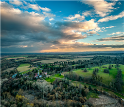
Because it is very much a family home, Welford Park house itself is rarely open to visitors. Not so, however, for the grounds, which are famous for their snowdrop display in early spring. Snowdrop opening times usually run from very late January through February. Check the website for current details.

If you are a horticulturalist you'll want to know that the snowdrops at Welford are primarily Galanthus Nivalis. They carpet the ground in a 5-acre beech wood beside the River Lambourn. Dotted amongst the beech trees are rare species like Lady Elphinstone and Lord Monstictus.

https://www.welfordpark.co.uk/

Land owner permission not required.

View and discuss this location in more detail on Grey Arrows.

Co-ordinates: 51.45607, -1.413458 • what3words: ///moved.whistling.funded

The originator declared that this location was not inside a Flight Restriction Zone at the time of being flown on 25/02/2023. It remains the responsibility of any pilot to check for any changes before flying at the same location.

Where to fly your drone


Recently added locations

Marsh Road Spalding (By Sammie99)

Drive as far down Marsh Road as you can. There are two concrete areas either side of the road which provide handy parking, watch out for the power lines over head. I don't know what this building's function is or was, I just thought it looked interesting.

Land owner permission not required.

View and discuss this location on Grey Arrows.

Co-ordinates: 52.8552, -0.07247 • what3words: ///require.pens.remaining

Victoria Park, Haywards Heath (By grandad1950)

I didn't expect the fair to be there but it makes a good image.

The park is used for many events throughout the year and gives good views across the town.

Land owner permission requirements unknown.

View and discuss this location on Grey Arrows.

Co-ordinates: 50.99792, -0.104573 • what3words: ///deals.flank.next

Braemar, Highland Scotland (By AlbionDrones)

The small town/village of Braemar, bisected by the Vlune Water, and nestled in the Cairngorm.

Sdly it as extremely windy on ou visit, so I only managed a short flight, but the river is stunning, there are plenty of historic buildings, and being surrounded by woodland and mountains - with a Caastle in the distance it makes for a fine subject...

There are good car parking options, a few decent shops to look around and several TOAL options, marked on the map, feel free to ad other markers as you find them...

Land owner permission requirements unknown.

View and discuss this location on Grey Arrows.

Co-ordinates: 57.00579, -3.399294 • what3words: ///generated.firms.losses

Dalnaglar Castle, Glen Shee (By AlbionDrones)

A stunning Baronial Castle glimpsed from the roadside.

Park up in the car park for the Clach na Coileach, and you can see the castle at about 500m away, behind some trees. Best approach would be to fly a little down the glen, then turn and fly up to the castle, with it being visible rather than being hidden by trees, but as can be seen I was chancing the mizzly weather, so wanted to keep the flight time to an absolute minimum...

Land owner permission requirements unknown.

View and discuss this location on Grey Arrows.

Co-ordinates: 56.76612, -3.398931 • what3words: ///teeth.gracing.mystified

Wakefield Cathedral (By richrab)

Wakefield Cathedral, or the Cathedral Church of All Saints in Wakefield, West Yorkshire, England, is a co-equal Anglican cathedral with Bradford and Ripon Cathedrals, in the Diocese of Leeds and a seat of the Bishop of Leeds. Originally the parish church, it has Anglo Saxon origins and, after enlargement and rebuilding, has the tallest spire in Yorkshire. Its 247-foot (75 m) spire is the tallest structure in the City of Wakefield. The cathedral was designated a Grade I listed building on 14 July 1953.

In a pedestrian zone, there is a lane and small courtyard just behind, Marked as TOAL point.

There is a RED FRZ in place but upon looking it is Helicopters only.
This area is close to the Prison FRZ so don't fly west from here.

Land owner permission not required.

View and discuss this location on Grey Arrows.

Co-ordinates: 53.68299, -1.496811 • what3words: ///guard.weep.rider

Tregoad Holiday Park (By lurch003)

Great place to stay, surrounded by fields and forests, and a great vantage point if you're brave enough to fly towards Looe Island

Land owner permission not required.

View and discuss this location on Grey Arrows.

Co-ordinates: 50.37805, -4.432871 • what3words: ///sectors.tunnel.fruits

Kinlochleven overlooking Loch (By Airlessmean)

on the final push of my walk ii had this beautiful view!

Land owner permission not required.

View and discuss this location on Grey Arrows.

Co-ordinates: 56.71656, -4.962602 • what3words: ///digestion.tailing.stewing

Kings house Hotel (By Airlessmean)

bit of kings house in the morning :) nice clouds over the mountain making an awesome atmosphere!

Land owner permission not required.

View and discuss this location on Grey Arrows.

Co-ordinates: 56.652, -4.8401 • what3words: ///accordion.agency.webcams

Bridge of orchy (By Airlessmean)

was a stunning view !

Land owner permission not required.

View and discuss this location on Grey Arrows.

Co-ordinates: 56.51809, -4.770609 • what3words: ///breakaway.pairings.create

island I VOW (By Airlessmean)

passing rowardenan and ivernaid hotel i stopped at a point and captured this stunning little island in the water on the loch lomond

Land owner permission not required.

View and discuss this location on Grey Arrows.

Co-ordinates: 56.27769, -4.696804 • what3words: ///obstruct.vocal.oath


Show All Locations

Service provided by