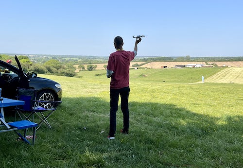
Where can I fly my drone in the UK and get £5,000,000 Public Liability Insurance cover? Welcome to Drone Scene!

Wondering where you can legally fly your drone? Looking for great places to fly? Looking for £5m Public Liability Insurance cover? Well look no further!

Welcome to Drone Scene, the place to find great drone flying locations in the UK, view images and videos posted by other pilots and share your flying locations in order to help other UK hobbyists find great locations where they can fly safely too.

Click on a marker pin to view details of that location. You can also add comments and discuss the location in our forum.

×You must login to see Airspace Restrictions, National Trust boundaries and other interactive map layers.

Edstone Aquaduct added to Bridges in West Midlands by Anonymous on 03/05/2018

Endcote Viaduct. This will be amazing in the summer with all the boats going through. Taken with DJI Mavic air at 1080P. No color correction

Land owner permission requirements unknown.

View and discuss this location in more detail on Grey Arrows.

Co-ordinates: 52.24604, -1.764121 • what3words: ///honeybees.clays.hers

Regulations are constantly changing. It remains the responsibility of any pilot to check for any changes before flying the same location.

Where to fly your drone


Recently added locations

Queens Drive (Walk) (By Bluesjnr)

Beware SSSI's around this area, especially during breeding season. Park in town and head South out of town.

Path can be accessed opposite caravan park at ///tour.contained.selling. The path will take you back into town (around 3 miles all in).

Land owner permission requirements unknown.

View and discuss this location on Grey Arrows.

Co-ordinates: 56.99943, -3.38886 • what3words: ///harps.earphones.airbrush

Strumble Head and Lighthouse (By Steviegeek)

I visited on a wet, windy and very grey day. I suggest you go on a nice sunny clear sky day 😃
There is parking space but no amenities. The lighthouse is open some days but don't know exactly when so if you want to go inside check beforehand to avoid disappointment

Land owner permission requirements unknown.

View and discuss this location on Grey Arrows.

Co-ordinates: 52.0298, -5.073543 • what3words: ///takers.bunkers.manicured

Blairgowrie and River Ericht (By AlbionDrones)

Blairgowrie is a small town in Perthshire, straddling the River Ericht, known as the home of Scottish Fruits greenhouses orchards and raspberry canes surround it. The town centre is small and can be walked in about 10 minutes, but backs onto the river, and a riverside park provides a lovely TOAL place.

Park on the road near the Wellmeadow square and you have an hour free parking.

Land owner permission requirements unknown.

View and discuss this location on Grey Arrows.

Co-ordinates: 56.59195, -3.335388 • what3words: ///desk.voucher.protrude

Durham Cathederal (By Briang97)

Good spot to toal gives a great capture of the horseshoe bend on the river with the castle and cathedral in the background, well worth a shot when the trees have autumn colour on.

You might get a warning from the prison as they've extended to zone but you are still within the distance from the prison to get some shots.

Land owner permission requirements unknown.

View and discuss this location on Grey Arrows.

Co-ordinates: 54.7733, -1.576323 • what3words: ///hands.flips.ties

South Norwood Country Patk (By grandad1950)

Wide open space in the London Borough of Croydon. Walks, woodland and lakes await.

Land owner permission requirements unknown.

View and discuss this location on Grey Arrows.

Co-ordinates: 51.39879, -0.05546 • what3words: ///librarian.wicked.loss

Cranfleet Cut and Cranfleet Lock (By Ubique_Photo)

I parked at the what3words location "rank.theme.rams" at the end of Pasture Lane and took a nice stroll along the river to the location shown on the map. It is a public right of way and was really quiet. But watch out for MTB's and I always gave room for any walkers etc, by moving the drone away.

Clearly privacy ethos living on the boats is to be kept in mind although they were lovely to chat to and just interested.
I then moved to a place nearer to the car park at the lock cafe to maintain visuals.

Land owner permission not required.

View and discuss this location on Grey Arrows.

Co-ordinates: 52.87805, -1.260413 • what3words: ///stick.epic.strike

Salford Park (By soumyodeep)

A spectacular view of Gravelly Hill Interchange, also known as Spaghetti Junction. I went to the Salford Park at 4 PM to take this picture, but I realize that the drone position was very close to the bridge. For this I was not able to cover the whole junction in one picture. At the time of flying there were no one in the park near to my position. I have made the TOAL from inside the park. I have not seen any "No drone" sign inside the park. Be careful while flying from here, as few people come here for fishing. The drone sound can be a problem for fishing. As I have flown my mini 3 which is a very low noise drone. I have no hear the drone sound because of the traffic Noise over the flyover. I am unsure the drone-flying inside park at Birmingham, as there is a controversial document (Policy) around. Which can be found here : https://greyarro.ws/t/is-sutton-park-birmingham-a-club-member-only-flying-space/30144/2?page=2

Land owner permission requirements unknown.

View and discuss this location on Grey Arrows.

Co-ordinates: 52.50935, -1.867935 • what3words: ///hello.lively.blows

Sixteen Acre wood trail (By Andytl6)

Enter from Berkswell church side part of the Millennium Way trail. After 5 mins walk opens up to open land lake and fields

Land owner permission not required.

View and discuss this location on Grey Arrows.

Co-ordinates: 52.40934, -1.651152 • what3words: ///stone.goad.scarcely

Cuckfield Park (By grandad1950)

Cuckfield Park is a privately owned Elizabethan house on the edge of Cuckfield in West Sussex.

Land owner permission requirements unknown.

View and discuss this location on Grey Arrows.

Co-ordinates: 51.00444, -0.151939 • what3words: ///enrolling.contemplate.cashew

The Brickfields, Bath (By FirstDriver)

A large, open park in Bath, with good VLOS and no wires. Parking shouldn't be a problem in this area as it's out of town. There is a shop close by, and also a shopping street which might prove difficult to park. Extensive views of the South of the city.

Land owner permission not required.

View and discuss this location on Grey Arrows.

Co-ordinates: 51.37663, -2.38648 • what3words: ///elaborate.reveal.artist


Show All Locations

Service provided by